Saturday, 11 July 2026
Digital crop monitoring platform moves toward national rollout after pilot success, strengthening food security planning and insurance design.
RIICE (Remote Sensing-based Information and Insurance for Crops in Emerging Economies) is poised to transform rice production monitoring in Kenya by delivering near-real-time, geo-localized data on rice area, yield and climate-driven crop losses. For a country where rice is a strategic staple and climate variability increasingly disrupts output, the digital platform offers policymakers, insurers and development agencies transparent, science-based production intelligence to guide decision-making.
Following successful implementation in major rice-producing countries across Asia, RIICE was piloted in Kenya between 2023 and 2024 under the CGIAR Digital Innovation Initiative. The pilot covered the Mwea Irrigation Scheme and selected schemes in western Kenya, in partnership with the Kenya National Irrigation Authority (NIA), Kenya Agricultural and Livestock Research Organization (KALRO), and the Ministry of Agriculture.
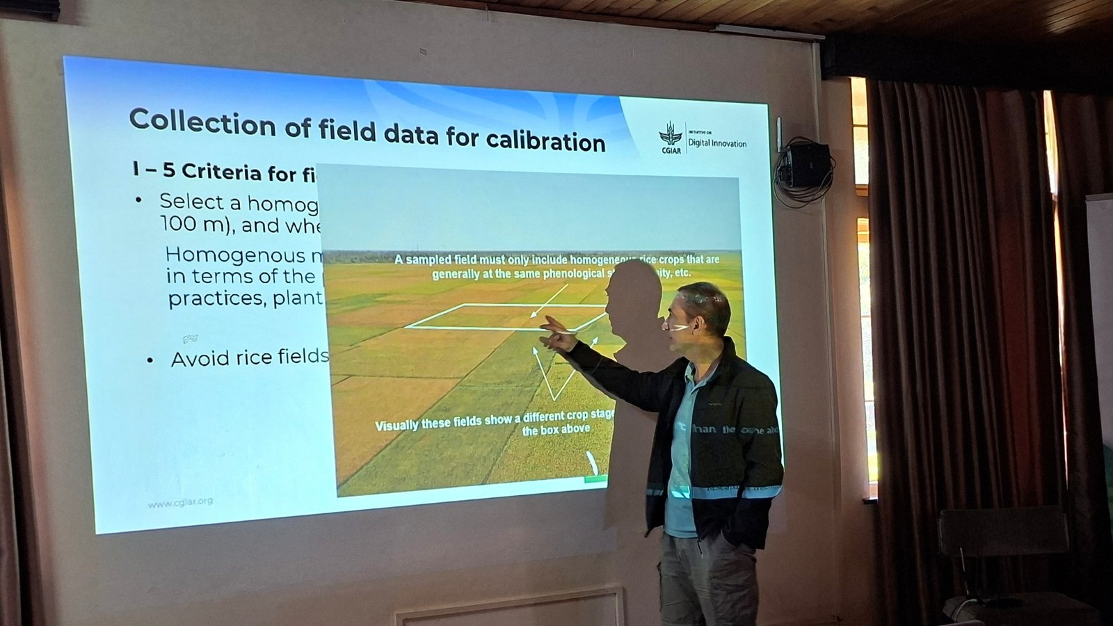
To initiate technology transfer to national institutions, a five-day technical training was conducted from December 1–5, 2025 at the Kenya Agricultural and Livestock Research Organization Food Crops Research Center (KALRO-FCRC) in Kabete. Supported by the CGIAR Digital Transformation Accelerator, the training brought together geospatial and remote sensing experts from KALRO, NIA, the Regional Centre for Mapping of Resources for Development (RCMRD), as well as leading academic institutions including the University of Nairobi and the Jomo Kenyatta University of Agriculture and Technology.
Advanced Satellite Analytics Meets Crop Modeling
Developed in partnership with sarmap, Switzerland, RIICE integrates time-series Synthetic Aperture Radar (SAR) satellite data with the ORYZA crop growth model through automated MAPscape-Rice and Rice-Yield Estimation System (Rice-YES) software workflows.
SAR imagery enables continuous monitoring even under cloud cover—an important advantage in tropical rice-growing regions. The system maps rice areas, detects planting dates and tracks canopy development, generating indicators such as start-of-season timing and leaf area index. These data feed into ORYZA simulations using localized weather, soil, variety and management inputs to generate in-season forecasts and end-of-season yield estimates.
The result is high-resolution, spatially explicit production data that can be aggregated at district or provincial levels for food security assessments and agricultural planning.
Strategic Value for Policy and Insurance
Kenya’s rice sector faces mounting pressure from climate shocks and heavy import dependency. Mid-season production forecasts and damage maps generated by RIICE allow government agencies to anticipate shortfalls and plan imports, relief programs or safety nets before crises escalate.
At the same time, insurers and reinsurers can leverage objective yield and loss estimates to design more precise agricultural insurance products and streamline claims processing. Over time, this strengthens smallholder resilience, stabilizes rice value chains and improves targeting of public investments in climate risk management.
“RIICE aims to provide governments, insurers and development actors with a consistent, objective view of where rice is grown, when it is grown, and how much yields and potential production losses are likely to occur,” said Dr. Renaud Mathieu, Senior Scientist at the International Rice Research Institute (IRRI).
Sammy Matara of the University of Nairobi underscored the platform’s policy relevance, noting that rice ranks among Kenya’s top five food staples. Accurate yield information, he said, is indispensable for national food security planning and import decisions.
Toward National Operationalization
Looking ahead, stakeholders are considering scaling RIICE to cover all irrigated schemes and rainfed rice ecosystems to ensure nationwide coverage. Operationalization will require advanced training, formalization of institutional roles, and establishment of standardized field data collection, mapping and dissemination protocols.
By embedding RIICE into Kenya’s national agricultural monitoring framework, partners aim to support sustained investment in data infrastructure and human capacity—positioning digital innovation at the center of climate-resilient rice production.
As climate risks intensify, timely and geo-localized intelligence may prove to be one of Kenya’s most strategic assets in safeguarding food security and strengthening the resilience of its rice sector.