Thursday, 25 June 2026

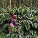
Agriculture in India is shaped by a fundamental divide between irrigated and rainfed systems, a distinction that determines cropping patterns, water use, productivity, and exposure to drought. Yet most national agricultural datasets available to policymakers remain too coarse to capture this reality at the field level, leaving planners and researchers without a precise understanding of where irrigation sustains production and where farmers remain vulnerable to rainfall variability.
Against a backdrop of intensifying climate extremes and rising competition for water, this data gap has become increasingly consequential. Responding to this need, researchers at the International Crops Research Institute for the Semi-Arid Tropics (ICRISAT) have developed a 10-metre resolution irrigated and rainfed cropland map of India for 2024–25, offering an unprecedented view of agricultural water dependence across the country.
The new dataset has been generated using dense Sentinel-2 time-series satellite data, complemented by field observations and analysis of seasonal crop behaviour. Prior to this effort, the research team had produced multiple cropland products for South Asia using Landsat-8 (30 m) and MODIS (250 m) datasets. The shift to higher-resolution imagery enables the new map to capture true field boundaries, mixed management practices, and transitions between irrigated and rainfed systems that are invisible in coarser national layers.
“As India is making steady progress towards sustainable water use under schemes such as the National Water Mission and More Crop Per Drop, water budgeting for agriculture is imminent. This map is a valuable resource for decision-makers and for guiding policy interventions,” said Dr Himanshu Pathak, Director General, ICRISAT.
The dataset achieves around 90 per cent accuracy in cropland mapping and nearly 70 per cent accuracy in distinguishing irrigated from rainfed systems, providing a robust and policy-relevant baseline for agricultural planning. Its high spatial detail allows users to identify vulnerable rainfed pockets, assess irrigation expansion, and better understand regional disparities in water access.
“As an international not-for-profit organization, we at ICRISAT anticipate this dataset will empower decision-makers at every level, from village panchayats to central government agencies, to better understand India’s semi-arid and irrigated landscapes and design targeted strategies for improving water-use efficiency,” said Dr Stanford Blade, Deputy Director General – Research & Innovation, ICRISAT.
To ensure broad accessibility, the maps are hosted on a user-friendly Google Earth Engine application, enabling users to visualise data at the district level, explore class-wise statistics, and interact with the dataset without requiring specialised geospatial processing skills.
“The dataset offers a sharper foundation for water budgeting, drought and risk monitoring, crop planning and yield modelling. It provides agencies and researchers with a consistent baseline to track shifts in irrigated areas, identify vulnerable rainfed pockets and design interventions that reflect on-ground realities,” said Dr Muralikrishna Gumma, Principal Scientist – Geospatial and Big Data Sciences, ICRISAT.
Together, the high-resolution map and its accompanying digital tool deliver a clearer, more actionable picture of India’s agricultural water landscape, strengthening the evidence base for policy, research, and operational decision-making. The work aligns with the Sustainable Development Goals 13 (Climate Action), 15 (Life on Land), 12 (Responsible Consumption and Production), and 17 (Partnerships for the Goals), reinforcing ICRISAT’s commitment to climate-resilient and data-driven agricultural development.