Friday, 17 July 2026

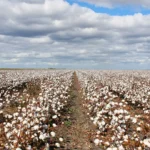
The study covering an area of 477 million hectares spanning across India, Pakistan, Nepal, Bhutan, Bangladesh and Sri Lanka, identified and mapped 27 major cropping systems.
Scientists at the International Crops Research Institute for the Semi-Arid Tropics (ICRISAT) recently released a study highlighting the role of geospatial maps and satellite data in shaping the future of food security. Focusing on South Asia, the research underscores how these advanced tools can significantly enhance agricultural productivity and sustainability. The study covering an area of 477 million hectares spanning across India, Pakistan, Nepal, Bhutan, Bangladesh and Sri Lanka, identified and mapped 27 major cropping systems.
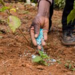
With only 6 annual harvests remaining before the 2030 Sustainable Development Goals (SDG) deadline, the need to sustainably intensify agricultural production has never been more urgent. Drylands, in particular, present a significant opportunity to enhance agricultural productivity and contribute to global food security.
“Dryland cropping systems are complex, shaped by biophysical, social, and economic factors. The use of geospatial products and satellite data for mapping these systems can be invaluable. These tools provide critical insights for decision-making, unlocking opportunities for increased production, and enhancing farmers’ incomes in these challenging environments,” said Dr Stanford Blade, Deputy Director General-Research at ICRISAT.
Highlighting the uniqueness of this research, Dr ML Jat, Global Research Program Director, Resilient Farm and Food Systems, stated “Predominantly, studies use spatial data to map single or major crops such as rice, wheat and sugarcane or to monitor crop intensity, natural vegetation and more. This study is a trailblazer in understanding the entire cropping system, i.e., crops grown in a sequence over the entire year.”
“This data serves as a foundational layer and can be used in various ways to understand and improve agricultural performance. When combined with climate and soil data, it can aid in planning for resource optimization and enhancing agricultural productivity,” noted the study’s lead author, Dr Muralikrishna Gumma.
On a global scale, these geospatial maps provide essential data that can guide climate change mitigation efforts. At the national level, these data sets offer a detailed understanding of regional cropping patterns, enabling governments to optimize resource allocation.
Geospatial mapping can inform policies that ensure the efficient distribution of resources like water, fertilizer, and seeds, based on the specific needs of different cropping systems. Additionally, these maps can be integrated into disaster management strategies, helping to identify areas vulnerable to agricultural stress, such as droughts or floods, and allowing for more targeted and effective responses.
The study Spatial Distribution of Cropping Systems in South Asia Using Time-Series Satellite Data Enriched with Ground Data (mdpi.com) was funded by the Japan Fund for Prosperous and Resilient Asia and the Pacific financed by the Government of Japan through the Asian Development Bank (ADB) and Mahalanobis National Crop Forecasting Centre (MNCFC), the Ministry of Agriculture and Farmers Welfare, Government of India, WRI Land & Carbon Lab grant convened by World Resources Institute, and the Bezos Earth Fund.