Friday, 17 July 2026

By
Rajesh Aggarwal, Managing Director, Insecticides (India) Limited
Following the liberalisation of drone restrictions in 2021, the industry received a huge boost with the announcement in this year’s Union Budget of Drone Shakti, a new integrated office in the Ministry of Civil Aviation to allow speedier growth, coordination, and approvals for drones. The government is currently supporting a number of drone entrepreneurs in order to increase their use across industries. Kisan Drones are already being utilised for crop assessments, land records, and insecticide spraying, and are projected to usher in a new era of technology in agriculture and farming. Drones with Artificial Intelligence (AI), Machine Learning (ML), and remote sensing capabilities are becoming increasingly popular due to their numerous benefits.
Drones in agriculture
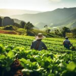
Drone technology has received the greatest attention due to its versatility and is seen as the agrarian sector’s future. Drones not only improve overall performance, but they also help farmers to overcome a variety of other obstacles and get several benefits from precision agriculture. They fill the void left by human mistake and inefficiency in traditional farming practices, with the market for agricultural drones expected to reach $5.7 billion by 2025, growing at a 35.9 percent CAGR. The goal of implementing drone technology is to eliminate any uncertainty or guesswork and instead focus on accurate and dependable data.
Farming is influenced by external elements such as weather, soil conditions, and temperature. A farmer can use an agriculture drone to adapt to different settings and make informed decisions. Crop health, crop treatment, crop scouting, irrigation, field soil analysis, and crop damage assessments are all aided by the information obtained. Drone surveys help farmers increase agricultural yields while reducing time and costs.
Role of drones in crop protection and productivity enhancement
Spraying of agrochemicals
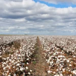
Drones are already being tested for use in the cotton-growing region of the country for spraying pesticides to reduce pests that would otherwise be handled by agricultural labourers, which is very time consuming and is also not uniform. Drones not only lessen the risk of unintended fume inhalation, but also expedite pest management by covering more areas in less time. The primary advantage of using a drone is that it will consume less insecticide and provide greater precision throughout the application process.
Controlling the Locust Swarm
The majority of countries fighting locust swarms rely heavily on organophosphate insecticides. In India, drones have been stationed in Rajasthan to ensure that the spraying is done efficiently. Drones can spray insecticides across a 2.5-acre area in under 15 minutes. The use of drones to battle locust swarms is a quick, safe, and practical solution.
Crop Health Surveillance and Monitoring
Tracking the health of the vegetation and spotting bacterial/fungal diseases early on is critical. Plants that reflect various quantities of green light and Near-Infrared Spectroscopy (NIRS) light can be identified by agriculture drones. This information is used to create multispectral images that can be used to track crop health. Crops can be saved if they are monitored closely and any faults are discovered quickly. In the event of crop failure, the farmer can document the losses in order to file proper insurance claims.
Agricultural drones equipped with multispectral and RGB sensors can also identify weeds, diseases, and pests in farm regions. The exact amounts of chemicals required to combat these infestations are known as a result of this research, which reduces the farmer’s costs.
Monitoring of Irrigation
Drones with hyperspectral, thermal, or multispectral sensors detect areas that are too dry or require the farmer’s attention. Irrigation monitoring yields calculations of the vegetation index to help realize the health of crops and emitted heat/energy. Drone surveys aid in bettering water usage and uncovering irrigation problems.
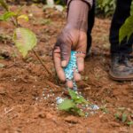
Soil Analysis in the Field
Farmers can use the drone survey to learn more about the soil conditions on their land. Multispectral sensors capture data that can be used for seed planting patterns, field soil analysis, irrigation, and nitrogen management. Farmers can thoroughly examine their soil conditions using precise photogrammetry/ 3D mapping.
Drone-planting systems have already been developed that allow drones to shoot pods, seeds, and essential nutrients into the soil. Not only does this technique cut expenses by over 85 per cent, but it also improves consistency and efficiency.
Tracking livestock
Farmers can use the drone survey to keep track of not only their crops but also their cattle’s movements. Thermal sensor technology aids in the recovery of missing animals and the detection of injury or illness. Drones are capable of performing this duty well, and this contributes significantly to the development of vegetation.