Friday, 15 May 2026
EOS Data Analytics (EOSDA), a satellite imagery analytics provider, recently announced plans to launch seven optical EOS SAT satellites into an LEO (Low Earth orbit) by the year 2024. By launching its own satellite imaging constellation, the company aims to establish a full satellite data production vertical – from direct imagery collection to processing, analysis and delivery.
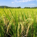
One of the key objectives of the new satellite constellation will be monitoring farmlands, making this project the first of its kind oriented towards agriculture. With these new satellites, EOS Data Analytics will increase the accessibility and accuracy of its satellite monitoring features. It will also help address pressing global challenges, such as climate change, land degradation, environmental threats, and more.
The EOS SAT satellites will feature 1.4 m panchromatic and 2.8 m multispectral Ground Sample Distance (resolution), 11 band channels, and a swath width of up to 40 km. The unique set of band channels utilized will precisely reflect agricultural needs. The constellation will also allow for a 3-day revisit time all around the globe. Each satellite is designed for a five-year work span.
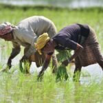
The EOSDA farming platform includes features such as crop health monitoring, crop classification, growth comparison, soil moisture estimation and weather prediction. It also offers: