Friday, 26 June 2026
AI-powered forecasting, hyperlocal platforms, and farmer-centric advisories position India Meteorological Department at the forefront of climate resilience and disaster preparedness
India is rapidly advancing its weather forecasting capabilities through a coordinated, technology-driven push led by the India Meteorological Department under the Ministry of Earth Sciences, aiming to deliver more precise, hyperlocal forecasts and early warnings in the face of rising climate volatility. Anchored by flagship initiatives such as Mission Mausam and the Monsoon Mission, the government is strengthening observational networks, deploying advanced radars, and integrating multi-source data using high-performance computing and next-generation modelling systems.
At the core of this transformation is the Bharat Forecasting System (BharatFS) and the newly developed Mithuna-FS, a global coupled forecasting system from National Centre for Medium Range Weather Forecasting. With a 12-km global resolution, a 4-km regional model for monsoons and cyclones, and a hyperlocal 330-m urban model for Delhi, Mithuna-FS integrates atmosphere, ocean, land, and sea ice dynamics, significantly reducing forecast biases. Combined with AI/ML post-processing and advanced tools like Pangu-Weather and GraphCast, the system has improved severe weather prediction accuracy by 30–40% over the past decade.
India’s forecasting ecosystem is also becoming increasingly citizen-centric. Platforms like Mausamgram—developed by IMD under the “Har Har Mausam, Har Ghar Mausam” initiative—deliver village-level, hyperlocal forecasts, enabling users to access hourly to 10-day weather updates via PIN code or administrative boundaries. Complementing this is IMD’s in-house Decision Support System (DSS), reinforcing the country’s Atmanirbhar Bharat vision through indigenous, technology-led solutions.
Artificial intelligence is playing a central role in this evolution. IMD has deployed AI/ML-based tools such as the Advanced Dvorak Technique for cyclone intensity estimation and meteoGAN, a deep learning model capable of rainfall downscaling at 300-meter resolution. Machine learning models are also being used for city-specific rainfall prediction, particularly in urban clusters like Delhi-NCR.
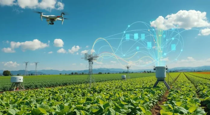
For India’s vast farming community, these advancements are translating into tangible benefits. Under the Gramin Krishi Mausam Sewa (GKMS), implemented in collaboration with the Indian Council of Agricultural Research, over 130 Agromet Field Units provide district-level weather forecasts and bi-weekly advisories tailored to 127 agro-climatic zones. These advisories guide farmers on critical decisions—from sowing and irrigation to fertilizer use—helping improve productivity and resilience.
The government has also scaled up dissemination through multi-channel platforms, reaching over 5.5 million farmers via SMS alerts and nearly 15.6 million through state-integrated digital platforms. Mobile apps like “Meghdoot” and “Mausam,” alongside social media and PPP-driven outreach, ensure real-time, location-specific updates, including early warnings during extreme weather events.
Further strengthening last-mile connectivity, IMD, in partnership with the Ministry of Panchayati Raj, has extended weather forecasting to the Gram Panchayat level through platforms such as e-Gramswaraj and the Meri Panchayat app. Additionally, AI-powered language tools like “Bhashini” are enabling dissemination of weather information in regional languages, ensuring inclusivity and accessibility.
As climate risks intensify, India’s integrated approach—combining advanced science, digital infrastructure, and grassroots outreach—is positioning the country as a global leader in hyperlocal, impact-based weather forecasting, with far-reaching implications for disaster preparedness, agricultural resilience, and economic stability.