Thursday, 25 June 2026

senseFly, a global firm that manufactures fixed-wing mapping drones, has announced the launch of eBee Ag, the latest addition to the eBee X series of drone solutions. User-friendly and affordable, eBee Ag helps farmers, agronomists and service providers efficiently capture aerial data and plant health insights for faster agronomic decision-making that can improve crop yields and profit potential.
“The agriculture industry has been lacking a viable mapping solution that offers professional results at a more accessible price,” explains Michael O’Sullivan, senseFly Head of Marketing. “The launch of the eBee Ag introduces an affordable fixed-wing solution that delivers the long flight times, range and efficiency—as well as the data quality, accuracy and resolution—that agriculture mapping projects require.”
Based on senseFly’s flagship eBee X fixed-wing drone, eBee Ag helps agriculture professionals overcome the many challenges they face in the field related to planning, plant health and crop monitoring. eBee Ag makes it easier than ever to field scout, ground-truth potential problem areas and gain critical crop health and field information.
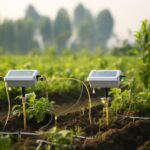
eBee Ag is suited for intensive and repeated crop mapping missions. Equipped with its standard battery, it is capable of up to 45-minutes of flight. An endurance battery increases flight times to up to 55 minutes—allowing eBee Ag to cover more than 160 hectares (395 acres) in a single flight and saving precious time and money when compared with conventional scouting.
eBee Ag features senseFly’s new, lightweight Duet M dual-sensor fixed payload, which comprises the senseFly S.O.D.A. RGB and Parrot Sequoia+ multispectral cameras. With its dual-purpose camera, eBee Ag captures accurate RGB and multispectral data from the sky to help make better decisions on the ground. Regularly collecting multispectral data is critical to effectively assess crop health, optimize inputs and catch early indicators of pests, diseases and weed infestations that threaten crop yields. Highly-accurate index maps allow agriculture professionals to understand each acre while managing problematic areas field-wide – before they impact profits.