Saturday, 18 July 2026


In this exclusive AgroSpectrum interview, Swapnil Jadhav, Founder & CEO of MapMyCrop, outlines how Monitoring-as-a-Service (MaaS) is redefining agricultural intelligence by shifting the sector from software-based tools to verified, outcome-driven visibility. He explains how MapMyCrop’s 6.2-million farmer validation network, multi-country crop intelligence, and proprietary AI models are solving agriculture’s long-standing “last-mile truth” problem at scale. Jadhav highlights how the company is emerging as the infrastructure backbone for data-driven agri-credit, parametric insurance, and climate-risk modelling as global finance moves toward intelligence-based lending.
Swapnil also details how MaaS is becoming central to India’s state-level policy decisions—optimising water, subsidies, and climate governance—while delivering dramatic on-ground impact, such as 60 per cent input savings and 50 per cent quality gains for orange growers. Looking ahead, he positions MapMyCrop as the regulated verification layer of the future, enabling every farm to be visible, every risk quantifiable, and every sustainability claim credible by 2030.
MaaS as a Market Redefinition
You call MapMyCrop the world’s first Monitoring-as-a-Service platform. What makes MaaS a true category-creation model rather than a rebranded form of agri-tech SaaS ?
Monitoring as a service isn’t a rebrand—it’s a fundamental shift in how agricultural intelligence is delivered. Traditional agri-tech SaaS used to provide software licenses but we at MapMyCrop provide verified, actionable insights as an on-demand service. What makes this category-defining is our Model-as-a-Service architecture: we deploy satellite imagery, weather analytics, and AI-driven crop models continuously across geographies, delivering real-time monitoring without requiring farmers or enterprises to own infrastructure, manage platforms, or interpret raw data. The customers utilize MapMyCrop’s platform for outcomes—verified crop health, yield forecasts, risk alerts—not for software they need to operationalize themselves. That’s the core differentiator, we’ve industrialized agricultural visibility.
The Economics of Visibility
Satellite intelligence, IoT, and field-level verification are capital intensive. What is the core lever that makes MaaS financially scalable—data monetisation, automation, or enterprise partnerships?
Our financial scalability relies on automation and our farmer validation network—not IoT or ground sensors, which are prohibitively expensive at scale. We leverage freely available satellite data and open weather sources, then apply our proprietary AI models to generate insights. The critical lever is our 6.2 million farmer network, which provides ground-truth validation at near-zero marginal cost. This creates a self-reinforcing loop, with more farmers means better model accuracy and then it leads to higher enterprise value which gives us more revenue per insight delivered.
We’re not just monetizing data but monetizing validated intelligence. Enterprise partnerships with insurers, banks, FMCGs, and governments—provide recurring revenue because they’re buying risk reduction and decision confidence, not dashboards.
Cracking the Ground-Truthing Barrier
Agriculture’s biggest bottleneck is not data scarcity but data validation. How does Map My Crop solve the “last-mile truth” problem that has historically limited insurers, banks, and food companies from making accurate, real-time decisions?
You’ve identified agriculture’s Achilles heel. Satellite data is abundant; trust is scarce. MapMyCrop solves the “last-mile truth” problem through our distributed farmer validation network spanning 6.2 million farmers across diverse geographies and partner ecosystems. These farmers act as our ground sensors validating crop stages, stress events, actual yields feeding real-world observations back into our AI models.
This isn’t crowdsourcing; it’s structured validation infrastructure. Combined with our multi-country deployment, we’ve built longitudinal datasets that capture how crops actually behave across microclimates, soil types, and farming practices, not how models predict they should behave.
For insurers, banks, and food companies, this means they can finally underwrite, lend, and procure based on verified field reality, not proxy indicators or farmer declarations. That’s the paradigm shift.
Transforming Agri-Credit and Insurance
As agri-finance shifts from collateral-based lending to data-based underwriting, how is Map My Crop positioning itself as the infrastructure layer for credit scoring, parametric insurance, and climate-risk modelling ?
We’re positioning MapMyCrop as the rails for data-driven agri-finance, the infrastructure layer that enables lenders and insurers to move from collateral-based to intelligence-based decision-making. Our platform delivers:
Our platform supplies granular credit-scoring inputs by analysing farm-level crop health trajectories, input application patterns, and yield-probability curves. It also strengthens parametric insurance design through verified stress-event data—such as drought, excess rainfall, or pest pressure—captured with precise timestamps and geo-tagged evidence. In addition, we deliver forward-looking climate-risk modeling that integrates evolving weather patterns, soil-moisture trends, and crop-vulnerability indices to help institutions anticipate and manage future exposure.Financial institutions don’t need to become agronomy experts; they plug into our MaaS layer and receive decision-ready intelligence. As agriculture financing scales to meet the $500B+ credit gap globally, verified monitoring infrastructure isn’t optional—it’s foundational.
Climate, Carbon, and Compliance
With Scope 3 emissions reporting and regenerative agriculture commitments rising globally, how central is carbon MRV and climate monitoring to your product roadmap? Do you foresee MaaS becoming mandatory for global agricultural supply chains?
Carbon MRV and climate monitoring are central to our roadmap—not as a feature, but as a core product vertical. With Scope 3 reporting mandates tightening and regenerative agriculture commitments accelerating, food companies and agri-processors need verifiable evidence of on-farm carbon sequestration, sustainable practices, and emissions reductions. Our satellite + AI + farmer validation architecture is purpose-built for this: we can monitor practice adoption, quantify biomass changes, and validate interventions at scale without deploying expensive IoT infrastructure.
Do I foresee MaaS becoming mandatory? Yes. Within 5 years, major agricultural supply chains will require continuous monitoring and third-party verification of sustainability claims. MapMyCrop is building that verification backbone today. The companies that don’t adopt this infrastructure will face compliance risk, supply chain opacity, and premium loss in ESG-conscious markets.
Defensibility in a Crowded Tech Landscape
With satellite analytics, crop models, and AI becoming increasingly commoditized, what is Map My Crop’s enduring moat—proprietary datasets, longitudinal crop intelligence, integrated advisory, or ecosystem lock-in ?
Our moat is longitudinal, validated crop intelligence across diverse agroecologies—and the farmer + partner ecosystem that continuously strengthens it. Satellite access is commoditized. AI models can be replicated. What cannot be easily replicated is:
We bring over six years of ground-validated crop performance data spanning multiple crops, geographies, and climate conditions, backed by a 6.2-million-farmer validation network that provides continuous real-time ground truth. This is reinforced by multi-country operational experience—whether it’s understanding how sugarcane behaves differently in Tamil Nadu compared to Uttar Pradesh, or how the economics of orange cultivation diverge between Nagpur and Madhya Pradesh.
Added to this is a network of embedded partnerships with state governments, input companies, and financial institutions, creating strong switching costs and making our ecosystem uniquely resilient and hard to replicate. Our defensibility isn’t technological—it’s systemic. We’ve built agricultural intelligence infrastructure that gets smarter with every season and every farmer interaction. Competitors can launch satellite analytics; they can’t replicate the depth and breadth of our validated knowledge graph.
Incorporating the India Success Stories Roorkee Pilot: From Weather Validation to Policy Intelligence
Your Roorkee deployment helped the Uttarakhand government validate weather data and evaluate evapotranspiration and irrigation models.
How do you convert such state-level pilots into long-term, scalable policy intelligence platforms across India?
The Uttarakhand government engagement demonstrated that accurate, localized intelligence changes policy decisions. By validating weather data and evaluating ET/irrigation models, we helped them move from assumptions to evidence-based resource planning.
Converting pilots into long-term platforms requires demonstrating fiscal and governance impact: water savings, subsidy optimization, crop insurance loss reduction. We’re now positioned to scale this across Indian states by:
We are focused on standardizing our policy intelligence modules—spanning water management, crop diversification, and input subsidy targeting—so they can be seamlessly deployed across diverse agro-climatic contexts. At the same time, we are integrating these modules with the existing workflows of state agricultural departments to ensure smooth adoption and minimal bureaucratic friction. Ultimately, the goal is to demonstrate clear return on investment through pilot results, showcasing improved policy outcomes, reduced wastage, and measurable gains in farmer welfare. State governments are increasingly data-hungry. We’re building the agricultural monitoring infrastructure they need for 21st-century governance.
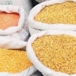
Nagpur & MP Oranges: 60 per cent Input Savings, 50 per cent Quality Gains
You helped orange growers reduce input costs by 60 per cent and improve fruit quality by 50 per cent.
What exactly were the agronomic interventions and digital workflows behind this transformation—and can this model be replicated across India’s horticulture belts at scale?
We used satellite and AI-based monitoring to detect crop stress—whether from water, nutrient, or pest issues—well before any visible symptoms appeared. Based on these early signals, we delivered timely and highly specific advisories through our farmer network and partners, prescribing exactly what intervention was needed, when to apply it, and where. This was reinforced by continuous feedback loops on ground performance, allowing us to validate what worked and refine our recommendations on a weekly basis.
The result: farmers stopped blanket-spraying and over-fertilizing. They applied inputs precisely when crops needed them, reducing waste dramatically while improving fruit size, color, and brix levels.
This model is scalable and replicable because it’s not dependent on expensive infrastructure—it’s driven by intelligence delivery. We’re now deploying similar approaches across pomegranate belts in Maharashtra, mango regions in AP, and banana clusters in Tamil Nadu. India’s horticulture sector is $80B+; precision agronomy at MaaS scale can transform its economics.
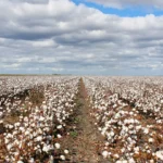
Sugarcane Across Baramati, UP, MP & Tamil Nadu: AI Across Agro-Climates
Sugarcane is grown in dramatically different soil, water, and climatic conditions across these states.
What did your AI-powered agronomy engine learn from deploying across such diversity, and how does that knowledge strengthen your national and global product strategy?
Deploying across such diverse sugarcane regions taught our AI engine something invaluable: crop performance is hyperlocal, but patterns are learnable.
We discovered:
Water stress manifests very differently across India’s agro-ecologies—Tamil Nadu’s red soils, for instance, face rapid moisture loss and demand tighter irrigation cycles, whereas Uttar Pradesh’s deep alluvial plains retain water longer but are prone to seasonal saturation. Pest pressure, too, follows distinct regional rhythms, with infestation cycles often varying by four to six weeks between zones due to shifts in temperature, humidity, and cropping intensity.
Even harvesting windows are no longer dictated by crop age alone; they are increasingly shaped by hyper-local microclimatic cues that determine sugar accumulation, moisture levels, and overall crop quality.This agroecological diversity strengthened our models exponentially. Our AI doesn’t just predict sugarcane yields; it understands which interventions work where and why. This cross-geography learning is now our strategic asset—when we enter new crops or new countries, we’re not starting from scratch. We’re applying battle-tested intelligence frameworks that adapt to local conditions quickly.
The 2030 Bet
If you had to define Map My Crop in a single sentence in 2030, what would it be? And what bold strategic bet are you making today that the industry still misunderstands or undervalues?
If I had to define Map My Crop in 2030 in one sentence: “Map My Crop is the global infrastructure for verified agricultural intelligence—the layer that makes every farm visible, every risk quantifiable, and every sustainability claim credible.”
The bold bet we’re making today that the industry undervalues: That agricultural monitoring will become regulated infrastructure, like financial audits or food safety inspections. Governments, financial institutions, and supply chains will mandate continuous, third-party-verified crop and land-use monitoring within this decade.
We’re not building a product; we’re building the rails that the future agricultural economy will run on. The industry still thinks this is a “nice-to-have” analytics tool. We know it’s tomorrow’s compliance requirement and competitive necessity.
— Suchetana Choudhury (suchetana.choudhuri@agrospectrumindia.com)